about Deprem Takip
Based on data taken from Boğaziçi University Kandilli Observatory and Earthquake Research Institute Regional Earthquake-Tsunami Monitoring and Evaluation Center, it shows earthquakes in real time and informs users. Increase your security and be informed about earthquakes with this application.
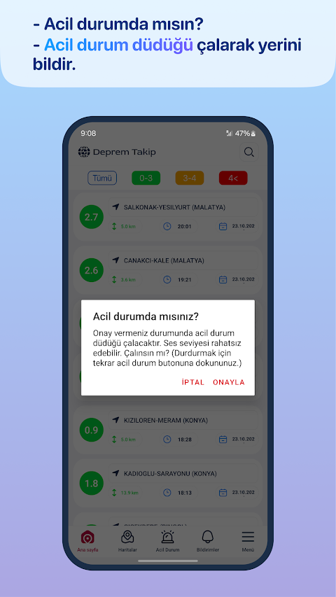
-Emergency Button: Equipped with a special button to ensure your safety in case of an earthquake. You can announce your location by making a whistle sound from this button.
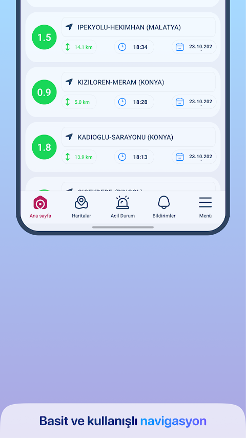
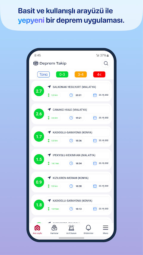
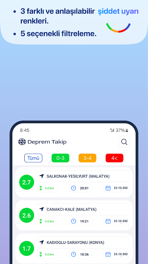
-Earthquake Filtering: The application allows you to filter earthquakes by their magnitude. You can view earthquakes of magnitude 0-3, earthquakes of magnitude 3-4 and earthquakes greater than magnitude 4 separately.
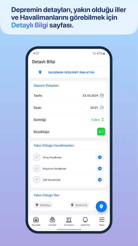
-Detailed Information: Examine the details of each earthquake. This section contains important information such as the magnitude of the earthquake, its depth, location coordinates and more.
-Nearby Provinces and Airports: Quickly observe the nearby provinces and airports affected by the earthquake. This helps you determine the precautions you should take after an earthquake.
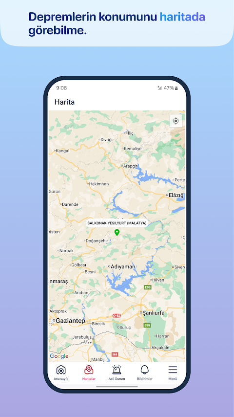
-Epicenter Display on Google Maps: It shows the exact epicenter of the earthquake on the map, so you can easily understand where the earthquake originated.
Notice for Google Policies: Our app does not represent and is not affiliated with any government organization.
Deprem Takip screenshots