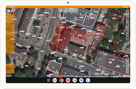
about InfoPlot - plot boundaries
InfoDziałka is a mobile application available on the Google Play platform that allows users to easily obtain, navigate and manage information about plots in Poland. The tool appreciated by the Head Office of Geodesy and Cartography (GUGiK)
________________________________________
Application functionalities
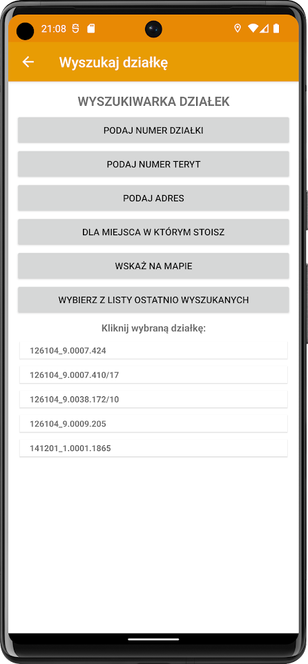
1. Plot location
• Plot number: Intuitive search using built-in dictionaries or the TERYT number.
• User location: Instant plot data based on your location.
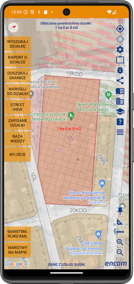
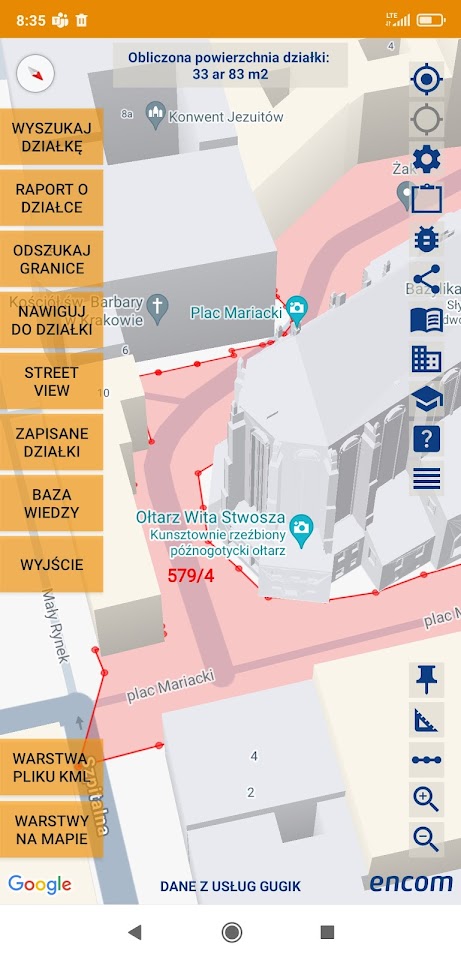
• Interactive map: Long-tap a selected point on the map to download plot data for this location.
• Plot address: Precise search based on the address.
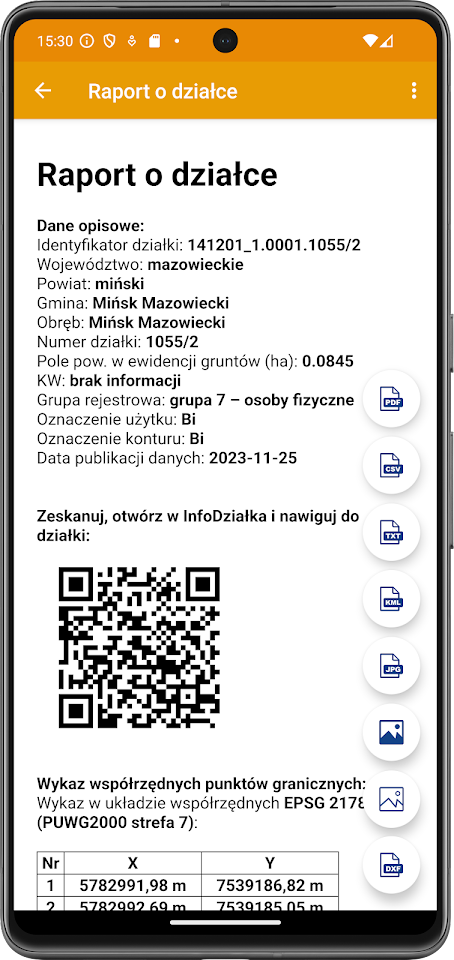
2. Downloading data
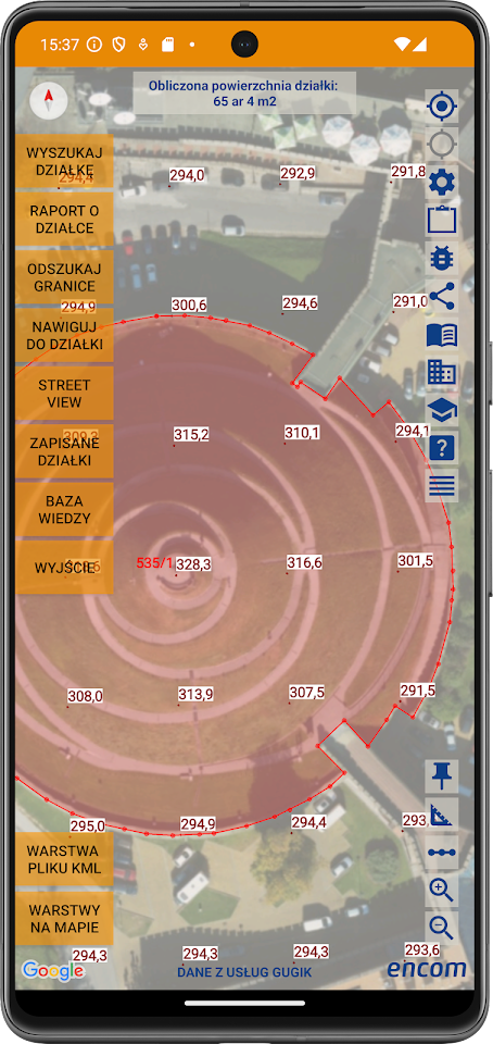
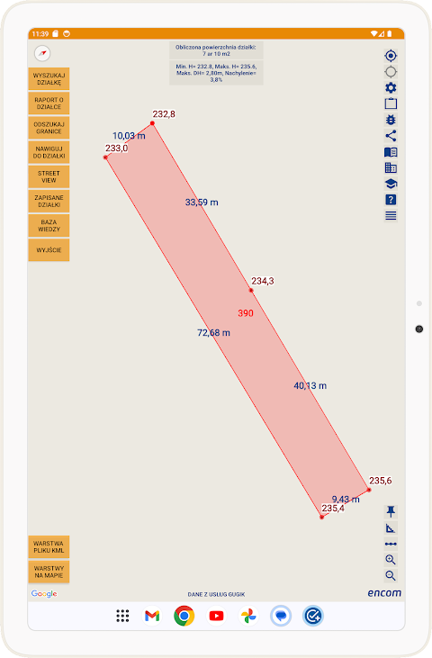
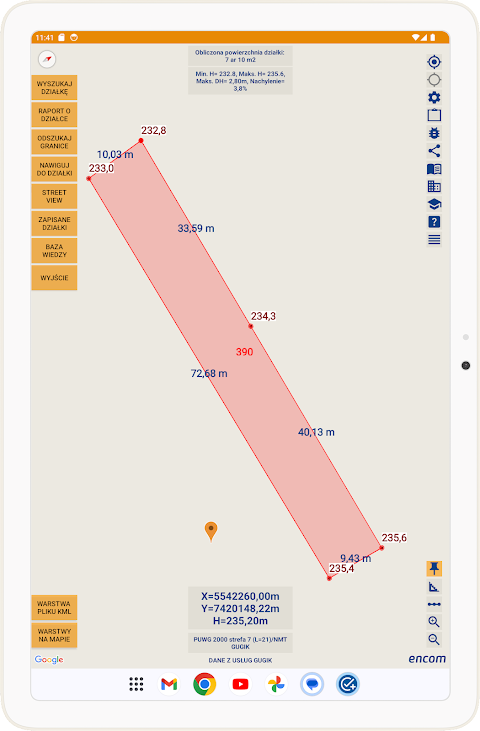
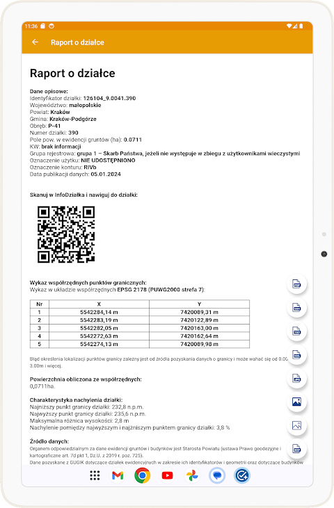
• Boundary coordinates: Available in XYH systems for surveyors and architects.
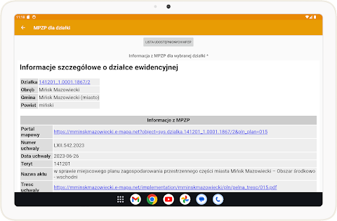
• Local Spatial Development Plan (MPZP): Check the purpose of the plot.
• Land development: Information about available technical infrastructure.
• Land records: Detailed data about neighboring plots.
• Terrain elevations: Accurate elevations from the Digital Terrain Model (DTM).
3. Creating reports
Generating reports in PDF, DXF, KML, CSV, JPG, TIFF, XML formats, including:
• Coordinates of boundary points.
• Maps with plot boundaries.
• Calibrated orthophotomaps.
• Metadata of photos and orthophotomaps.
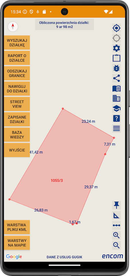
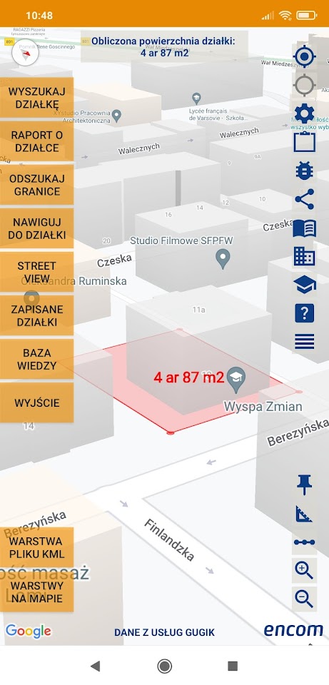
4. Navigation
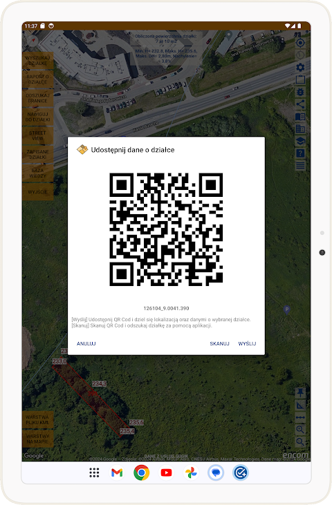
The built-in function allows you to navigate to any plot or boundary points with the mobile application and generate QR codes or sharing links.
________________________________________
Additional functions
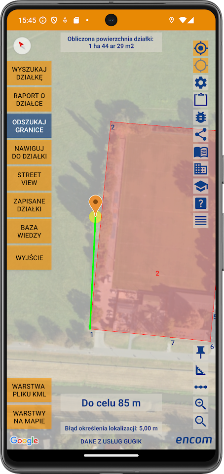
Precise location of boundary points
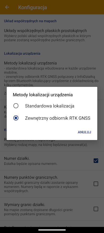
The application uses:
• Smartphone: Accuracy of 1-2 meters.
• RTK GNSS E1 measurement set: Accuracy of 1-3 cm for the most demanding users.
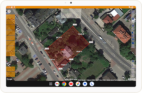
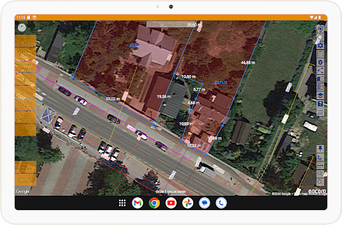
Measurements on the map
• Distances between boundary points.
• Areas based on orthophotomaps.
• Distance to technical infrastructure.
Data recording and collection
• Aggregation of information about plots with the possibility of export to the cloud.
• Full documentation for real estate agents, owners and farmers.
Offer presentation
Ability to generate detailed presentations of plots with maps, photos and additional information about the property.
________________________________________
RTK GNSS E1 measurement set
Advanced GNSS receiver with multifunctional capabilities that increases the precision of measurements. Available at a price of PLN 5,000 gross, it allows you to quickly obtain an RTK FIX position in the field.
Technical specifications:
• Multi-constellation receiver: GPS, GLONASS, Galileo, BeiDou.
• Compatibility with CAD and ASG EUPOS corrections.
• USB-C power supply, resistance to outdoor conditions (IP67).
________________________________________
Cost and availability
• Free version: Limited functionality.
• Annual subscription: PLN 97 available on Google Play.
The subscription can be transferred to other devices by assigning it to a Google Play account.
________________________________________
Ideal for:
• Plot owners: Checking boundaries, utilities, dimensions.
• Real estate agents: Documentation and presentation of offers.
• Farmers: Precise crop planning.
Download the InfoDziałka application now and enjoy access to complete information about every plot in Poland!
InfoPlot - plot boundaries screenshots